Tag archive

fire - page 3

CAL FIRE California Statewide Fire Summary for Sunday Morning, September 20, 2020

in Around California

September 20, 2020 - Containment continues to increase thanks to the efforts of firefighters on 27 major wildfires in California, as well as one extended attack wildfire. With nearly 19,000 firefighters on the front lines, crews continue to gain ground on these fires, as well as responding to 25 initial attack wildfires across the State, all of which were contained quickly.

Since the beginning of the year, there have been over 7,900 wildfires that have burned over 3.5 million acres in California. Since August 15, when California’s fire activity elevated, there have been 26 fatalities and over 6,100 structures destroyed.

Breezy conditions in the Santa Barbara County, Los Angeles Mountains and Antelope Valley continue today, contributing to poor humidity recovery.  Warm conditions remain through most of California, and will continue into the week.  An upper ridge of high pressure is expected to bring warmer and dry conditions to Southern California with a chance of wind events starting mid-week.

Continue Reading on Sierra Sun Times

CalFire orders evacuations east of San Jose city limits

in Around California

SAN JOSE — The California Department of Forestry and Fire Protection late Wednesday ordered residents living east of San Jose’s city limits to evacuate as the SCU Lightning Complex Fire neared the area.

The evacuation order also applies to areas south of Mt. Hamilton Road; north of Metcalf and San Felipe roads, east to the county line; and east of San Antonio Valley Road to Del Puerto Canyon Road to the county line.

In addition, the following areas are under an evacuation warning as a result of the fire:

  • East of Shingle Valley Road and everything east of Anderson Lake, east of Coyote Creek, east of Coyote Reservoir, east of Roop Road, east of Leavesley Road, east of Crews Road and east of Ferguson Road
  • East and north of Highway 152
  • West of the Merced County line, north of Highway 152
  • South of Metcalf Road at Shingle Valley Road east to the Stanislaus County line

A photo tweeted by the National Weather Service showed flames burning close to the Lick Observatory on Mt. Hamilton.

Continue Reading on Mercury News

Evacuations ordered as Canyon Zone grows to 10,000 acres in Stanislaus County | Update

in News

STANISLAUS COUNTY, Calif. — The so-called Canyon Zone Fire forced officials to call for some evacuations in Stanislaus County.

In a post to Facebook, StanEmergency issued mandatory evacuations for people on Del Puerto Canyon Road from Frank Raines Park west to Mines Road due to increased fire activity.

Stanislaus County officials are also advising Diablo Grande residents to be packed and ready to go in case a mandatory evacuation order is issued.

The Canyon Zone Fire is a total of six fires burning northwest of Patterson near Del Puerto Canyon.
Continue Reading on ABC 10

Fire Tornadoes Reported in Northern California Wildfire

in Weather

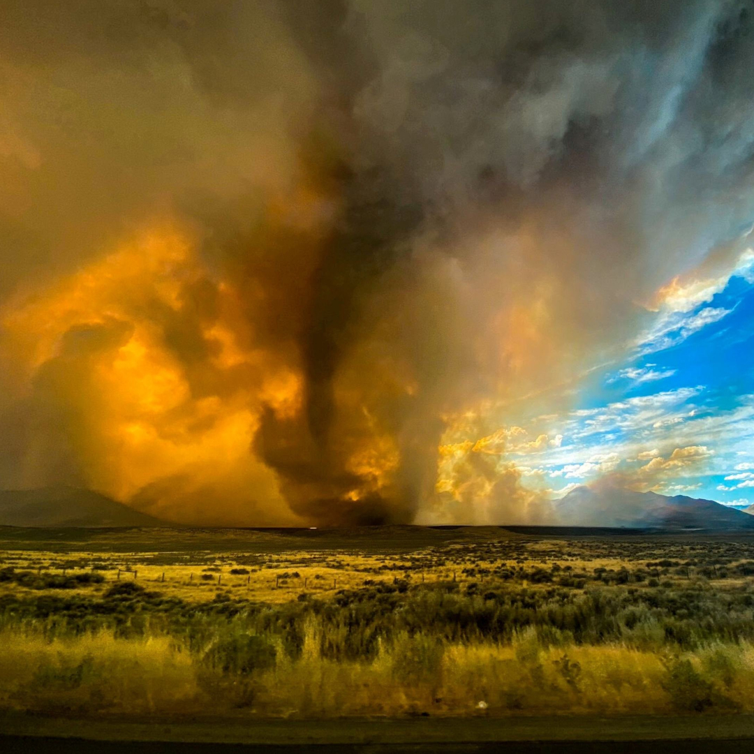
The National Weather Service said it was planning to investigate reports of a rare occurrence of fire tornadoes arising on Saturday from a 20,000-acre wildfire in Northern California.

Dawn Johnson, a meteorologist with the service in Reno, Nev., said on Sunday that the agency had received reports of fire tornadoes in an area of Lassen County, Calif., about 25 miles northwest of Reno.

“It’s not like a typical tornado where it happens, everything clears out and you safely go and investigate,” Ms. Johnson said. “In this case, there’s a massive wildfire burning in the same location, so the logistics are a lot more complicated.”

Continue Reading on New York Times

California Wildfire Map, Updates on Loyalton Fire, Brentwood Fire, Azusa Fire

in Around California

California is experiencing several major wildfires amid a record-breaking heatwave. Thousands of acres have been burned and evacuation orders are in place across various counties, including Los Angeles and Monterey.

The National Weather Service forecasts that the heatwave will continue across the west coast of the U.S. for the next few days, with excessive heat warnings and heat advisories in place.

Record high temperatures are forecast and the persistent heat and dry conditions will also promote wildfires across the region. Additionally, thunderstorms could produce dry lightning that could lead to the development of additional fires.

Continue Reading on News Week

River fires blamed on arsonist

in Environment

Several fires that scorched about 20 acres scenery along the Tuolumne River near the Mitchell Road bridge was started by an arsonist, said Ceres Fire Chief Kevin Wise.

Chief Wise said that an arsonist started lighting fires on the northeast side of the Mitchell Bridge and continued into Legion Park. Units from Ceres, Hughson, Modesto, Stanislaus Consolidated, Denair and Burbank Paradise worked over the next several hours to contain the fire. Through the local resource sharing agreement, Turlock City Fire Department sent a fire engine and a battalion chief to cover the Ceres station while all of Ceres Fire’s units were out.

“Unfortunately there were no arrests made,” said Dustin Bruley, supervisor of the Stanislaus Fire Investigation Unit. “Our investigators still have it as an open arson investigation. We believe that it was an arson; there were actually four separate fires along the river that were investigated that day. Multiple folks were stopped and field interrogated and unfortunately at this point we don’t have any suspect information.”

Continue Reading on Ceres Courier

Diablo Fire Breaks Out In Stanislaus County; 220 Acres Burned

in News

STANISLAUS COUNTY (CBS SF) – An ongoing vegetation fire in Stanislaus County has burned through 300 acres as of Thursday morning, Cal Fire reports.

The Diablo Fire, as it is being called, was reported around 12:15 a.m. Thursday morning, in the area of Del Puerto Canyon and Diablo Grande, several miles west of the town of Patterson.

Cal Fire stated the fire as having burned about 20 acres when it was reported, but quickly grew to 100 to 150 acres as of approximately 1:00 a.m.

As of about 10:50 a.m., Cal Fire tweeted that the Diablo Fire has scorched 202 acres and is 50 percent contained. The agency previously said the fire burned 300 acres and 20 percent contained, but better mapping of the area prompted the revised numbers.

Continue Reading on San Francisco CBS Local

Fire rips through Keyes egg plant

in Around California

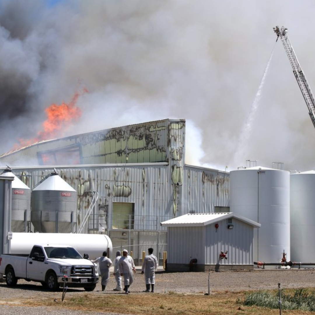
Strong winds helped fan the flames on a major fire that consumed a west Keyes agriculture industrial building used to process poultry eggs Thursday afternoon.

Multiple fire agencies including Ceres, Keyes, Hughson, Turlock and Modesto responded to the fire which broke at 12:59 p.m. at the Gemperle Farms facility on Bystrum Road south of Bronco Winery and east of Crows Landing Road. Flames broke out in the northern most of two buildings, sending up a large plume of smoke visible from Modesto to Delhi.

Gemperle Farms said they lost 280,000 chickens in the fire. No human injuries were reported.

“The building was completely involved when I arrived,” said Ceres Fire Battalion Chief Jeff Serpa, “so anything that was inside is going to perish.”

Continue Reading on Turlock Journal

California wildfires are mostly under control, but fire risk remains high

in Local Roundup

The California wildfires that scorched thousands of acres and prompted mass evacuations across the state in recent weeks are largely under control, but experts warn that hot and dry conditions will continue to elevate fire risk throughout the week.

The Maria fire, which broke out atop South Mountain just south of Santa Paula in Ventura County on Thursday night and spread to nearly 10,000 acres, was 70% contained as of Sunday evening, according to the Ventura County Fire Department. All mandatory evacuation orders were lifted Saturday.

“We’re pretty much in the mop-up stage,” fire Capt. Steve Kaufmann said.

Continue Reading on Los Angeles Times

At least 14 wildfires are burning in California

in Local Roundup

(CNN)Firefighters in California have been batting numerous blazes nonstop, trying to save millions of people and homes from the flames.

The biggest fire, the Kincade Fire, has incinerated parts of the wine country in Sonoma County since last week. Further south, multiple wildfires continue spreading near Los Angeles and surrounding counties.
Here are all the wildfires currently threatening the state, from the most active to those nearing full containment:
Continue Reading on CNN
Go to Top